Indian Geography Questions from Assam Exams: 50 Previous Year MCQs with Answers
Every indian geography question from 15 real Assam recruitment papers, in one place. Use it to see which facts come up again and again.
Where these questions were asked
| Exam | Questions |
|---|---|
| ADRE | 40 |
| APSC CCE Prelims | 7 |
| Assam Police Constable | 2 |
| Assam TET | 1 |
Most-asked subtopics
| Subtopic | Questions |
|---|---|
| Rivers | 6 |
| Mountain ranges | 5 |
| State capitals | 4 |
| Himalayan peaks | 2 |
| Cities of India | 2 |
| Mineral resources | 2 |
| Directions and locations | 2 |
| North-East India | 1 |
| Airports | 1 |
| Ports | 1 |
| Natural vegetation | 1 |
| Agriculture | 1 |
| States of India | 1 |
| Mountain peaks | 1 |
| Islands | 1 |
All 50 questions
-
If an airplane is flying directly from Chennai towards Guwahati, in which direction
is it flying?- A From South to East
- B From East to West
- C From West to East
- D From North to East
Show answer
Answer: (A) From South to East
Official final answer key
-
What is the Westernmost State of India?
- A Rajasthan
- B Punjab
- C Maharashtra
- D Gujarat
Show answer
Answer: (D) Gujarat
Official final answer key
-
Which of the following peaks does not belong to the Himalayas?
- A Annapurna
- B Kangto
- C Anamudi
- D Kamet
Show answer
Answer: (C) Anamudi
Official final answer key
-
Which of the following mountain ranges is in North-East India?
- A Barail Range
- B Shivalik Range
- C Satpura Range
- D Aravalli Range
Show answer
Answer: (A) Barail Range
Official final answer key
-
Which of the following statements is incorrect?
- A Lakshadweep is a Union Territory of India.
- B Maldives is a Union Territory of India.
- C Andaman and Nicobar Islands is a Union Territory of India.
- D Puducherry is a Union Territory of India.
Show answer
Answer: (B) Maldives is a Union Territory of India.
Official final answer key
-
Which of the following countries is the farthest from Andaman and Nicobar Islands ?
- A Myanmar
- B Indonesia
- C Vietnam
- D Malaysia
Show answer
Answer: (C) Vietnam
Official final answer key
-
Which of the following statements is correct ?
- A Sikkim shares border with Assam.
- B Sikkim lies towards the west of Assam.
- C Assam shares borders with Sikkim and Meghalaya.
- D Bangladesh and Sikkim touch the borders of Assam.
Show answer
Answer: (B) Sikkim lies towards the west of Assam.
Official final answer key
-
Siachen in Ladakh is an example of :
- A Cold desert
- B Glacier
- C Plateau
- D Snow mountain
Show answer
Answer: (B) Glacier
Official final answer key
-
Which of the following mountain ranges is in Jammu and Kashmir region ?
- A Pir Panjal range
- B Satpura range
- C Dhauladhar range
- D Mishimi Hills
Show answer
Answer: (A) Pir Panjal range
Official final answer key
-
Moreh (Manipur) is a road connection point of India with which country ?
- A Thailand
- B Nepal
- C Myanmar
- D Bhutan
Show answer
Answer: (C) Myanmar
Official final answer key
-
Which of the following is the highest mountain peak of India ?
- A Everest
- B Annapurna
- C Nanda Devi
- D Kanchenjunga
Show answer
Answer: (D) Kanchenjunga
Official final answer key
-
Which of the following is the Capital City of Chhattisgarh ?
- A Raipur
- B Ranchi
- C Bhagalpur
- D Dehradun
Show answer
Answer: (A) Raipur
Official final answer key
-
Which mountain range passes through Delhi, Haryana, Rajasthan and Gujarat ?
- A Shivalik range
- B Borail range
- C Satpura range
- D Aravalli range
Show answer
Answer: (D) Aravalli range
Official final answer key
-
How many countries does India share land borders with ?
- A Six
- B Seven
- C Eight
- D Nine
Show answer
Answer: (B) Seven
Official final answer key
-
Kurseong is a hill station in the state of :
- A Sikkim
- B Arunachal Pradesh
- C West Bengal
- D Nagaland
Show answer
Answer: (C) West Bengal
Official final answer key
-
Identify the southernmost river amongst the following :
- A Indus River
- B Godavari River
- C Brahmaputra River
- D Cauvery River
Show answer
Answer: (D) Cauvery River
Official final answer key
-
Name the State in which the Thar Desert is located.
- A Punjab
- B Haryana
- C Rajasthan
- D Maharashtra
Show answer
Answer: (C) Rajasthan
Official final answer key
-
Looking from Assam, in which general direction is New Delhi located?
- A North-East
- B West
- C South-West
- D South
Show answer
Answer: (B) West
Official final answer key
-
Which of the following States is known to have highest coal reserves?
- A Jharkhand
- B Maharashtra
- C Karnataka
- D Mizoram
Show answer
Answer: (A) Jharkhand
Official final answer key
-
Identify the incorrect pair of State and capital city of India.
- A Uttarakhand : Mussoorie
- B West Bengal : Kolkata
- C Chhattisgarh : Raipur
- D Goa : Panaji
Show answer
Answer: (A) Uttarakhand : Mussoorie
Official final answer key
-
Which statement is not correct?
- A Visakhapatnam is a port city of Andhra Pradesh.
- B Narmada is a river.
- C Kanchenjunga is a Himalayan peak.
- D Chilika Lake is in Gujarat.
Show answer
Answer: (D) Chilika Lake is in Gujarat.
Official final answer key
-
Near which landmark is the Atal Tunnel situated?
- A Khardung La Pass
- B Rohtang Pass
- C Sela Pass
- D Umling La Pass
Show answer
Answer: (B) Rohtang Pass
Official final answer key
-
The range which separates Indo-Gangetic Plains of Northern India from the
Deccan Plateau of Southern India is- A Karakoram Range
- B Satpura and Vindhya Range
- C Aravalli Range
- D Pir Panjal Range
Show answer
Answer: (B) Satpura and Vindhya Range
The Vindhya-Satpura ranges separate the northern plains and Deccan region.
Worked solution by AxomRank (no official key was published)
-
Amongst the following rivers, which one does not originate from the
Himalayas ?- A Indus
- B Ganga
- C Yamuna
- D Narmada
Show answer
Answer: (D) Narmada
The Narmada rises at Amarkantak, outside the Himalayas.
Worked solution by AxomRank (no official key was published)
-
The State of Northeast India that does not share borders with Bangladesh, is
- A Manipur
- B Tripura
- C Meghalaya
- D Mizoram
Show answer
Answer: (A) Manipur
Manipur does not border Bangladesh.
Worked solution by AxomRank (no official key was published)
-
Find the odd one out.
- A Gangtok
- B Imphal
- C Agartala
- D Dimapur
Show answer
Answer: (D) Dimapur
Dimapur is not a state capital; the other three are.
Worked solution by AxomRank (no official key was published)
-
Pakyong airport is located in
- A Arunachal Pradesh
- B Sikkim
- C Manipur
- D Mizoram
Show answer
Answer: (B) Sikkim
Pakyong Airport is in Sikkim.
Worked solution by AxomRank (no official key was published)
-
Which of the following is presently considered as the highest Himalayan
peak of India ?- A Kanchenjunga
- B Nanda Devi
- C Kamet
- D Mana
Show answer
Answer: (A) Kanchenjunga
Kanchenjunga is the highest listed peak on India's internationally administered territory.
Worked solution by AxomRank (no official key was published)
-
Which mythical underground river is considered to have joined Ganga and
Yamuna at Triveni Sangam of Prayagraj (formerly Prayag of Allahabad) ?- A Bhagirathi
- B Alakananda
- C Saraswati
- D Satadru
Show answer
Answer: (C) Saraswati
The traditional third river of the Triveni Sangam is Saraswati.
Worked solution by AxomRank (no official key was published)
-
Which of the following mountain range is geologically considered the oldest ?
- A Pir Panjal Range
- B Vindhya Range
- C Aravalli Range
- D Western Ghats
Show answer
Answer: (C) Aravalli Range
The Aravalli range is the oldest among the options.
Worked solution by AxomRank (no official key was published)
-
Which one amongst the following is the southernmost river in India ?
- A Cauvery
- B Godavari
- C Narmada
- D Mahanadi
Show answer
Answer: (A) Cauvery
The Cauvery is the southernmost of the listed rivers.
Worked solution by AxomRank (no official key was published)
-
In which state of India does the Barak river originate ?
- A Assam
- B Manipur
- C Mizoram
- D Meghalaya
Show answer
Answer: (B) Manipur
The Barak originates in Manipur.
Worked solution by AxomRank (no official key was published)
-
Which of the following places is adjacent to New Delhi ?
- A Gurugram
- B Nandigram
- C Secunderabad
- D Dhanbad
Show answer
Answer: (A) Gurugram
Gurugram adjoins the Delhi urban area.
Worked solution by AxomRank (no official key was published)
-
Which of the following is not a sea-side city of India ?
- A Bengaluru
- B Chennai
- C Mumbai
- D Cochin
Show answer
Answer: (A) Bengaluru
Bengaluru is inland.
Worked solution by AxomRank (no official key was published)
-
By which name is the river Brahmaputra known after it joins the river
Ganga in Bangladesh ?- A Lohit
- B Hooghly
- C Padma
- D Siang
Show answer
Answer: (C) Padma
The combined Ganga-Brahmaputra channel is called Padma before joining the Meghna.
Worked solution by AxomRank (no official key was published)
-
Which of the following city has a sea port ?
- A Cochin
- B New Delhi
- C Kolkata
- D Bhopal
Show answer
Answer: (A) Cochin
Cochin is a coastal seaport; Kolkata is an inland river port.
Worked solution by AxomRank (no official key was published)
-
What is the capital of Jharkhand ?
- A Raipur
- B Ranchi
- C Dehradun
- D Gangtok
Show answer
Answer: (B) Ranchi
Ranchi is Jharkhand's capital.
Worked solution by AxomRank (no official key was published)
-
The place associated with gold mine in India is
- A Jaduguda
- B Kolar
- C Ankleshwar
- D Kalahandi
Show answer
Answer: (B) Kolar
Kolar is associated with gold mining.
Worked solution by AxomRank (no official key was published)
-
Which of the following trees is not considered as an example of deciduous
vegetation ?- A Sal
- B Mango
- C Pine
- D Simalu
Show answer
Answer: (B) Mango · (C) Pine
Both mango and pine are evergreen rather than deciduous; both printed choices satisfy the question.
Worked solution by AxomRank (no official key was published)
-
Which region is Jhum cultivation usually practised in ?
- A Wetlands
- B Hill sides
- C Char areas
- D Flat plains
Show answer
Answer: (B) Hill sides
Jhum is shifting cultivation commonly practised on hillsides.
Worked solution by AxomRank (no official key was published)
-
Arrange the following rock systems of India in chronological order of formation :
1. Dharwar Rock System 2. Vindhyan Rock System
3. Archaean Rock System 4. Gondwana Rock System
Select the correct answer using the codes given below.
1 → 3 → 2 → 4 3 → 2 → 1 → 4
1 → 2 → 3 → 4 (3 → 1 → 2→ 4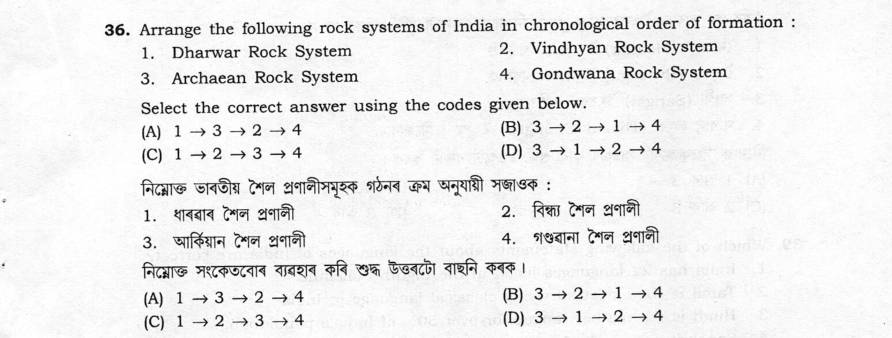
Show answer
Answer: (D)
Official provisional answer key
-
Consider the following statements :
1. The monsoon winds always blow from land to sea during summer.
2. The Bay of Bengal branch brings ranifall to North-East India.
3. El Niño leads to weaker monsoon rainfall in India.
4. Tamil Nadu receives most of its rainfall during the North-East monsoon.
Select the correct answer using the codes given below.
1, 2, 3 and 4 (1, 3 and 4 only
2 and 3 only 2, 3 and 4 only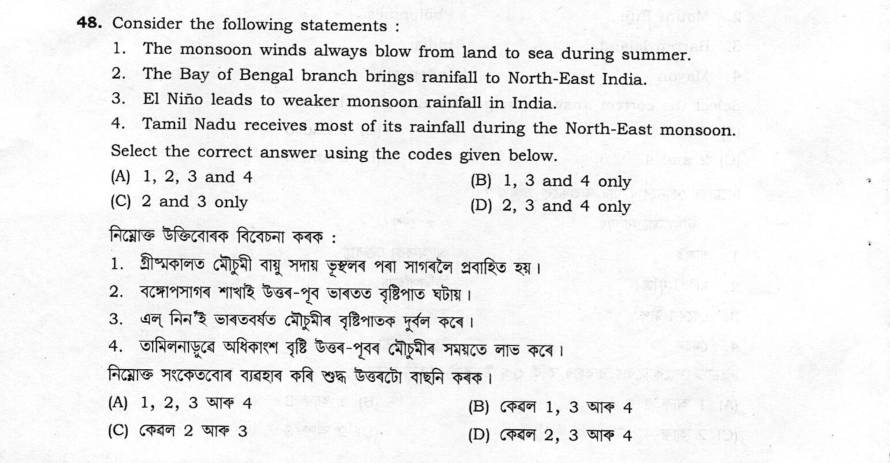
Show answer
Answer: (D)
Official provisional answer key
-
Tropical rainforests in India are mostly distributed in
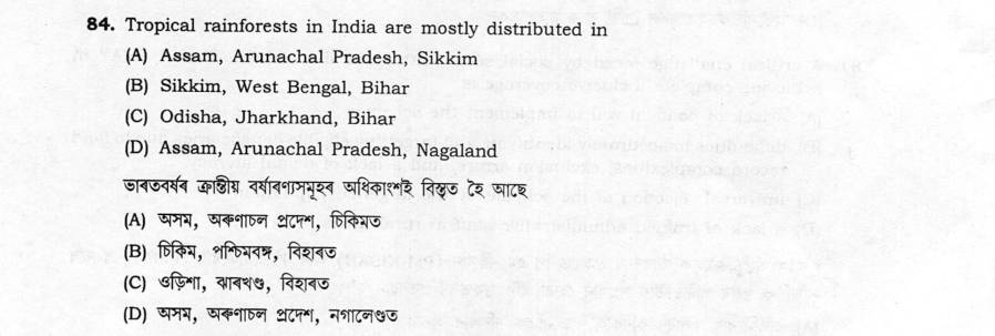
- A Assam, Arunachal Pradesh, Sikkim
- B Sikkim, West Bengal, Bihar
- C Odisha, Jharkhand, Bihar
- D Assam, Arunachal Pradesh, Nagaland
Show answer
Answer: (D) Assam, Arunachal Pradesh, Nagaland
Official provisional answer key
-
The Union Government has designated various waterways in India as National
Waterways under the National Waterways Act, 2016. The National Waterway 2 (two)
connects which stretch of rivers?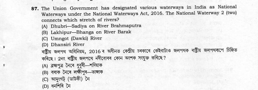
- A Dhubri—Sadiya on River Brahmaputra
- B Lakhipur—Bhanga on River Barak
- C )Umngot (Dawki) River
- D Dhansiri River
Show answer
Answer: (A) Dhubri—Sadiya on River Brahmaputra
Official provisional answer key
-
Which of the following pairs
concerning canal irrigation of India
is/are not correct?
(i)Agra Canal—Yamuna River
(ii) Upper Bari Doab Canal—
Jhelum River
(ii) Sirhind Canal—Ravi River
(iv Bikaner Canal-Satluj River
Select the correct answer using the
codes given below.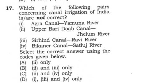
- A (ii) only
- B (ii) and ii) only
- C i) andv only
- D (i),(ii) and (iv) only
Show answer
Answer: (B) (ii) and ii) only
Official provisional answer key
-
In India during 2001 to 2011, the
number of census towns showed
rapid growth (increased by a total of
2500 in number) compared to
statutory towns (increased by about
250 in number). The rapid growth of
census towns was because of
(i) formation of municipal board/
committee and notified town
area committee, etc.
(ii) rapid growth of population
leading to cross the minimum
requirement of 5000 inhabi-
tants to qualify as a town
(iii) the town area becoming densely
populated with more than 400
persons per square kilometre
(v) three-fourths of the male
workforce found full-time jobs
beyond agriculture activities
Select the correct answer using the
codes given below.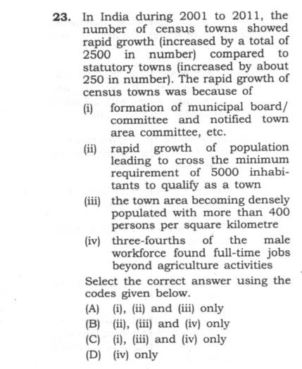
- A (i), (ii) and (iii) only
- B (ii),iii)andivonly
- C (i), (iii) and (iv) only
- D ivonly
Show answer
Answer: (B) (ii),iii)andivonly
Official provisional answer key
-
Match the following Particularly
Vulnerable Tribal Groups (PVTGs)
(List-I) with the States/Union
Territories they belong to (List-II) :
List-I List—Ⅱ
a. Maram 1. Andaman and
Nicobar Islands
b. Jarawa 2. Tripura
c. Birhor 3. Manipur
d. Reang 4. Odisha
Select the correct answer using the
codes given below.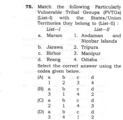
- A a b c d 1 2 3 4
- B a b c d 3 1 4 2
- C a b c d 2 1 4 3
- D a b c d 3 4 1 2
Show answer
Answer: (B) a b c d 3 1 4 2
Official provisional answer key
-
Consider the following statements regarding the Z-Morh Tunnel (Sonamarg Tunnel) :
1. It is a part of Zojila Tunnel Project.
2. The 6·5 km long tunnel connects Gagangir and Sonamarg region in Jammu and
Kashmir.
3. The project comes under the supervision of the National Highways Authority of India.
Which of the statements given above is/are correct?- A 1 and 2 only
- B 1 only
- C 2 and 3 only
- D 2 only
Show answer
Answer: (A) 1 and 2 only
Official provisional answer key
-
The largest river island in India is situated in
- A Bihar
- B West Bengal
- C Odisha
- D Assam
Show answer
Answer: (D) Assam
Official provisional answer key
-
According to 2011 census female literacy rate of India is :
- A 74%
- B 82.1%
- C 60.5%
- D 65.5%
Show answer
Answer: (D) 65.5%
The provisional 2011 census female-literacy figure in the options is 65.5%.
Worked solution by AxomRank (no official key was published)
Sources and corrections
From the open AxomRank PYQ dataset. Each question links back to its paper. See how to report a correction.